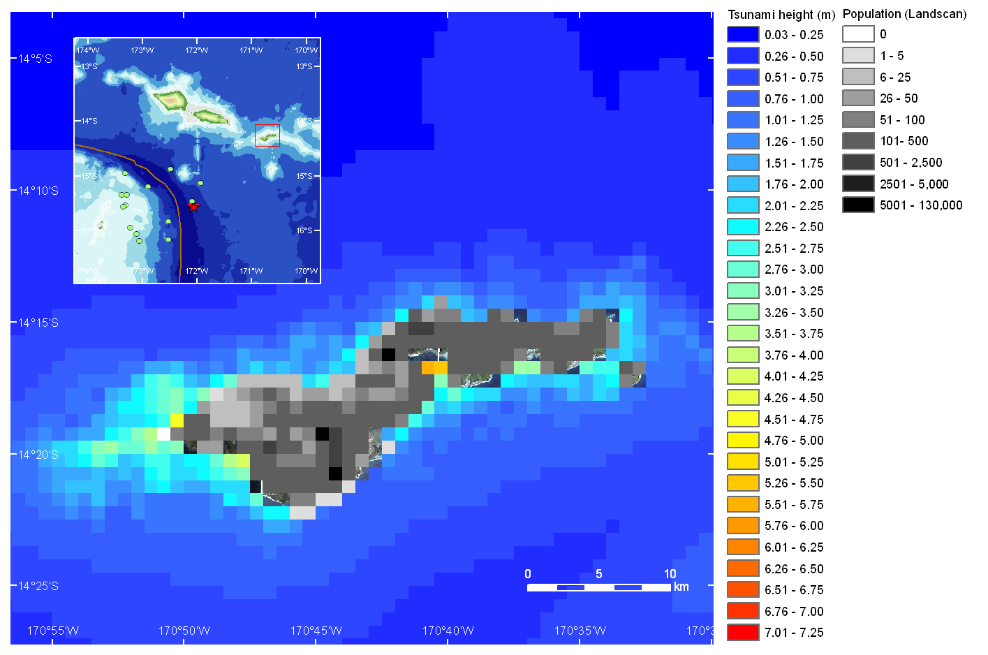
 Modeled tsunami height and exposed population (Click the image for full size version)
How fast can we detect the impact of natural disaster ? This is a very critical problem to be solved in order to reduce the fatalities by any kinds of natural disasters. Recent advances of seismology, numerical modeling with modern computing power, remote sensing, and GIS analysis expands the capability to detect the impact of major tsunami disaster, as reported herein.
We performed the tsunami propagation model after the event occurred. The model result is combined with world population database (Landscan) to explore the potential impacted area. The model suggests that the population in Pago Pago is highly exposed against the tsunami.
Modeled tsunami height and exposed population (Click the image for full size version)
DigitalGlobe achieved a quick observation of Americal Samoa by Quickbird satellite, approximately four hours after the earthquake occurred (The earthquake was occurred at 17:48, 29 September 2009 ; USGS). Probably, this is the first case that the satellite observation was made just right after the tsunami attack. We acquired a set of pre and post tsunami images of American Samoa, to inspect the impacted area, as our model suggested.
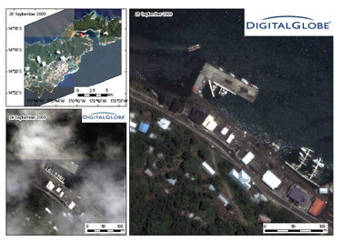
Damage in a small harbor in Pago Pago (Click the image for full size version).
Pre and post tsunami QuickBird images in Pago Pago. Structural destruction by inland penetration of the tsunami can be interpreted (Click the image for full size version).
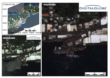
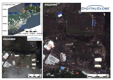
A shipyard (?) in Pago Pago. The floating tsunami debris can be found (Click the image for full size version).
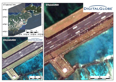
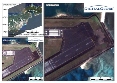
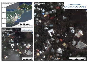
Tsunami inundation in Pago Pago international airport. Tsunami debris can be seen on the runway. The white fragments are likely to be corals (Click the image for full size version).
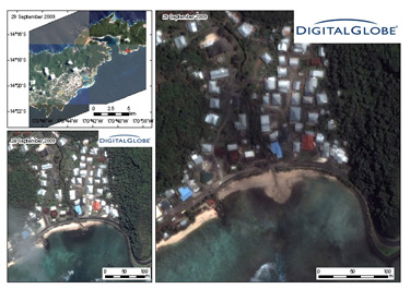
Geomorphological change (?) at a small river mouth (Click the image for full size version).