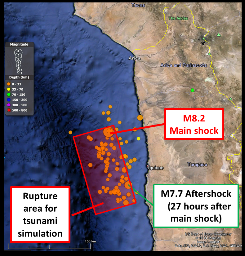
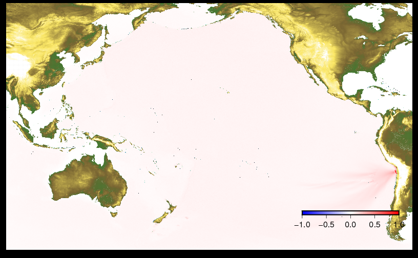
On April 2nd, 2014 at 8:46 AM (JST), a magnitude 8.2 earthquake occurred in the northern part of Chile where the, Iquique gap , is known as the seismic gap with one of the highest possibility of producing earthquakes. However, the Iquique gap witnessed no significant earthquake since 1900. This time, the earthquake not only caused significant damage due to its strong ground motion but also generated landslides and fire. Tsunami warnings were initially issued for many countries in the west coast of South America but were eventually limited to Chile and Peru. More than 2m of tsunami was observed in Iquique where many tens of fishing boats were damaged. A total of six people were killed and 970,000 people evacuated from their homes. The tsunami also impacted other countries such as the United States (in Hawaii) where the maximum tsunami amplitude of 0.58m was observed.
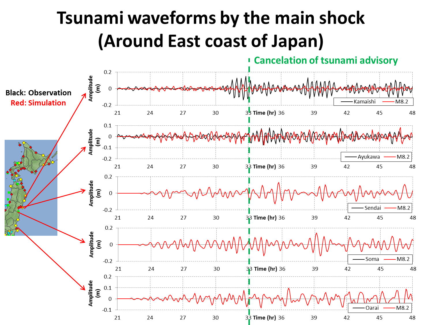
In Japan, tsunami advisories were issued and the maximum tsunami amplitude of about 0.60 was observed with an average of 0.2 - 0.3 m along the east coast. A tsunami advisory was issued 18 hours (3 AM of 3rd April) after the earthquake and the advisory was canceled 15 hours later (6 PM of 3rd April or 33 hours after the earthquake) In fact, the 2010 tsunami generated by M8.8 earthquake in Chile hit Northern Japan with a tsunami height of more than 1m causing damage caused by inundation and damage to offshore aquaculture. The tsunami this time was differed slightly as the earthquake magnitude is lower and the direction of tsunami energy was going in a southward direction. As a result, there was no damage reported in Japan. Tsunami evacuation shelters were opened and prepared by the local government but there was a lesser number of evacuees because of the tsunami level was only at advisory, where evacuations are not mandatory. However, even at that level, people should not stay near the coast, yet there were reports of people who ignored the advisory and continued their activities.
Distribution of aftershocks(Some figures are added by Tohoku University )
Source: USGS
: Google Erarth
For original figure, click the image below.
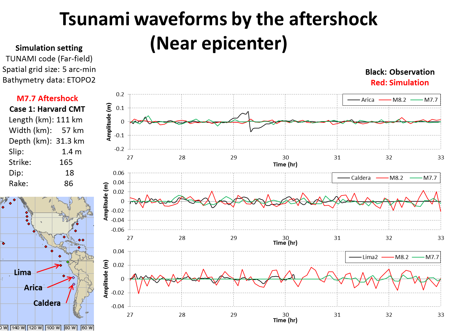
Near epicenter
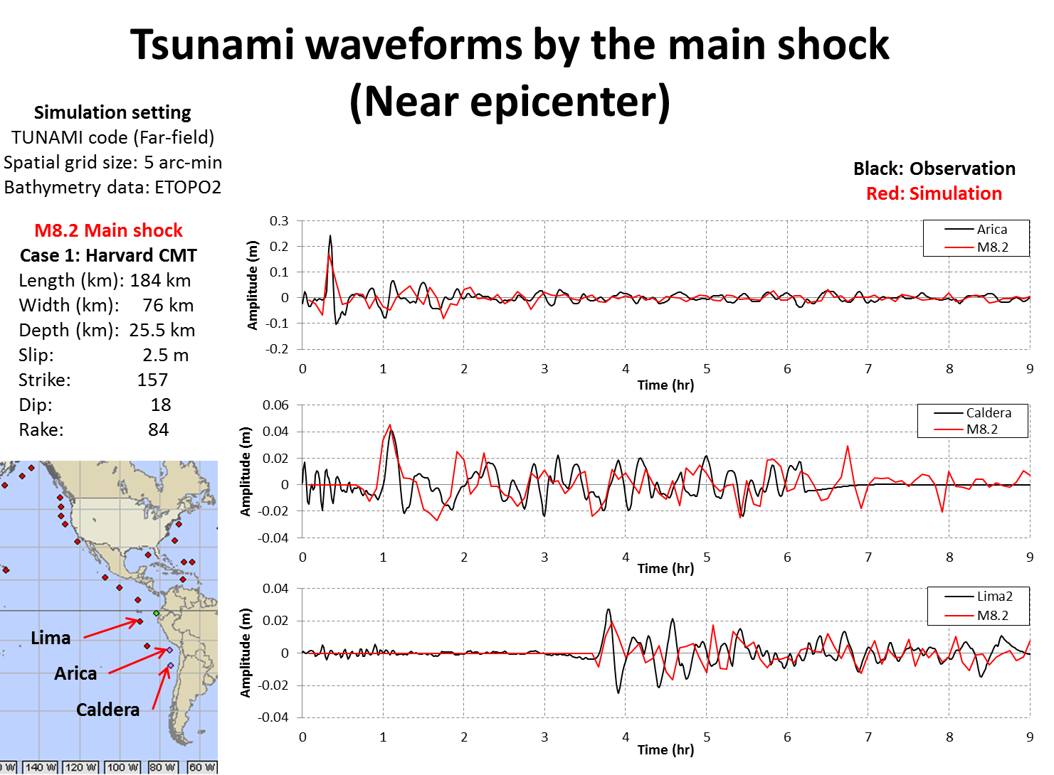
Source(Observation,Map) NOAA
Source(Simulation) Tohoku University
Tohoku(North)
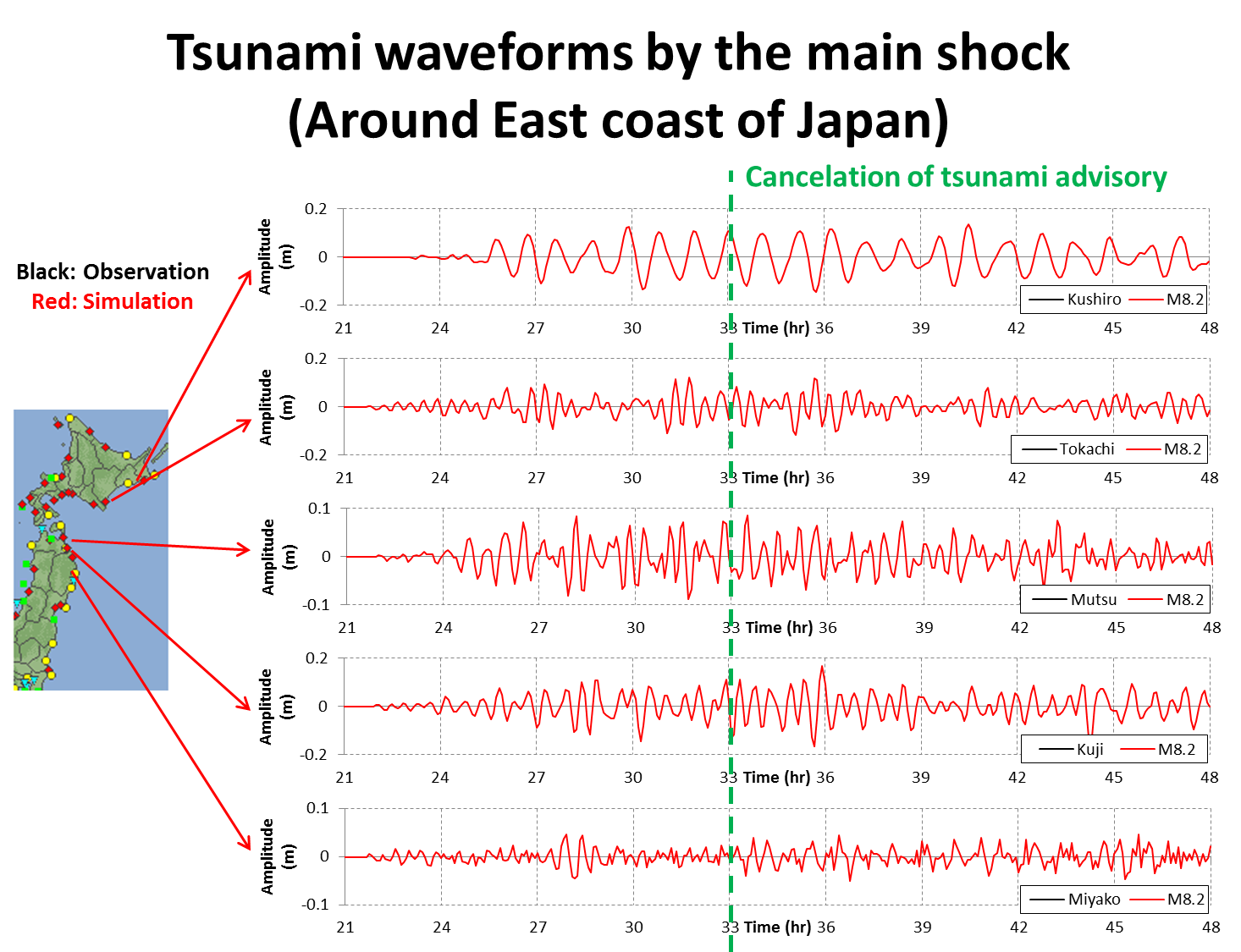
Source(Observation,Map) JMA
Source(Simulation) Tohoku University
Tohoku(South)
Source(Observation,Map) JMA
Source(Simulation) Tohoku University
Near epicenter
Source(Observation,Map) NOAA
Source(Simulation) Tohoku University
![]()
by:
F. Imamura, K. Imai, M. Abdul, S. Horiuchi, A. Hisamatsu, A. Tanobe, F. Makinoshima, M. Watanabe
(Tsunami Engineering, Hazard and Risk Evaluation Research Division)
S. Sato
(Disaster Digital Archive, Disaster Information Management and Public Collaboration Division)
A. Suppasri, Y. Fukutani and Y. Abe
(Earthquake induced Tsunami Risk Evaluation (Tokio Marine), Endowed Research Division)