Modeling the Tsunami of 27 February 2010 in Chile
Disaster Control Research Center, Tohoku University

Useful Information
General
- CNN
- Reuters
Emergency Response
- ReliefWeb
- OCHA Situation Reports
Seismology
- USGS
Tsunami Observation
- WCATWC web site
Maps
- University of Texas Libraries
Modeling the Tsunami of 27 February 2010 in Chile
DCRC, Tohoku University
Tsunami Model Description
- Geverning Equation : Linear Shallow Water Equations (Far-field model), Non-linear Shallow Water Equations (Near-field model)
- Numerical Scheme : Leap-frog Finite Difference Method (TUNAMI-CODE of Tohoku University)
- Spatial Grid Size : 5 arc-min. (Far-field model), 30 arc-sec. (Near-field model)
- Bathymetry Data : GEBCO
- Population Data : Landscan
Tsunami Source Model
Case 1
- Mo = 2.0 x 10**22 Nm
- Fault Length / Width : 450 km / 100 km
- Source Mechanism (Strike, Dip, Slip) = (16, 14, 104) Reference :USGS
- Dislocation : 15 m
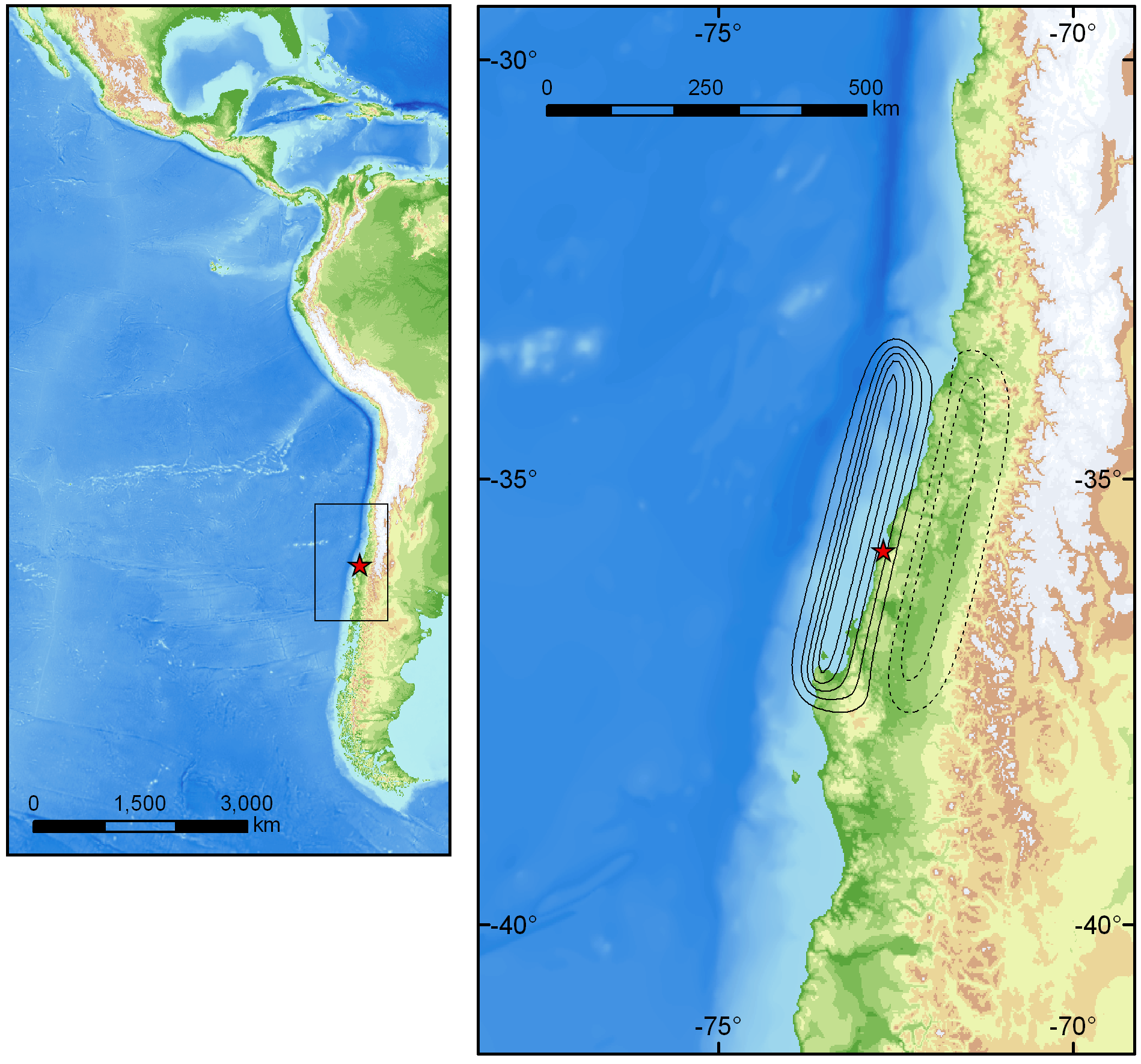
Seismic Deformation Model Result
For original resolution, click the image below.
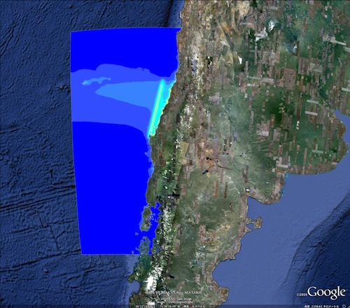
Case 1
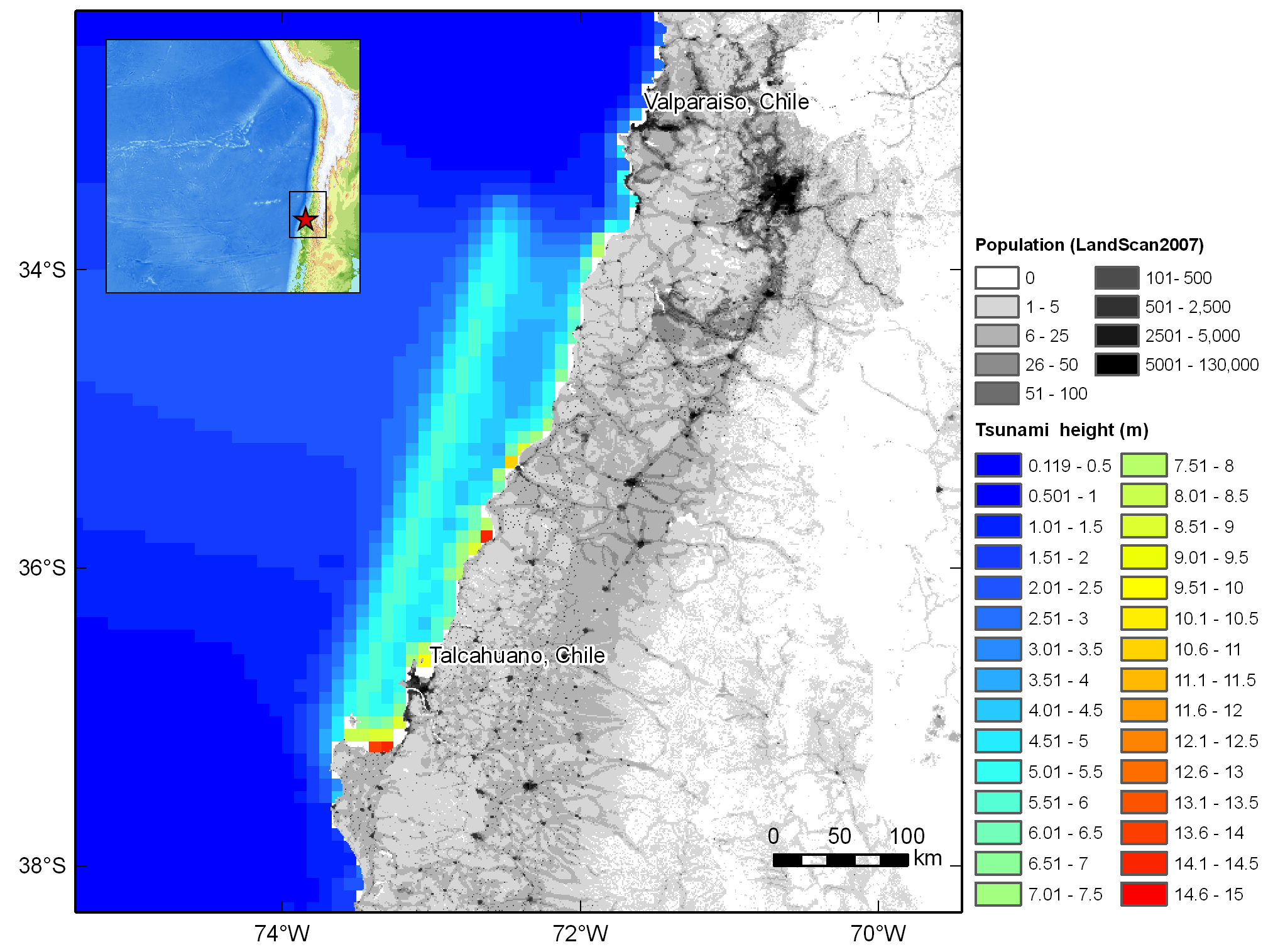
Near-field Tsunami Model Result and exposed population
Google Earth KML (Modeled tsunami height), click the image below
Full report (PDF, 2MB), click the image below
Mid-ocean Tsunami Propagation Model Movie(QuickTime Required)
Click to play(1.6MB)
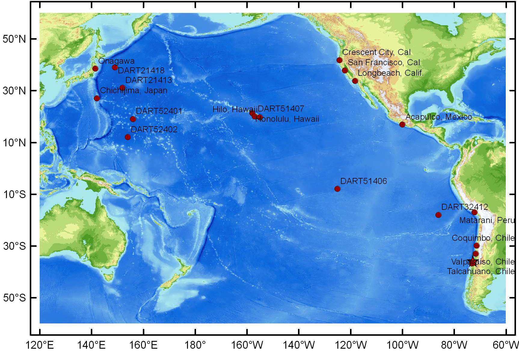
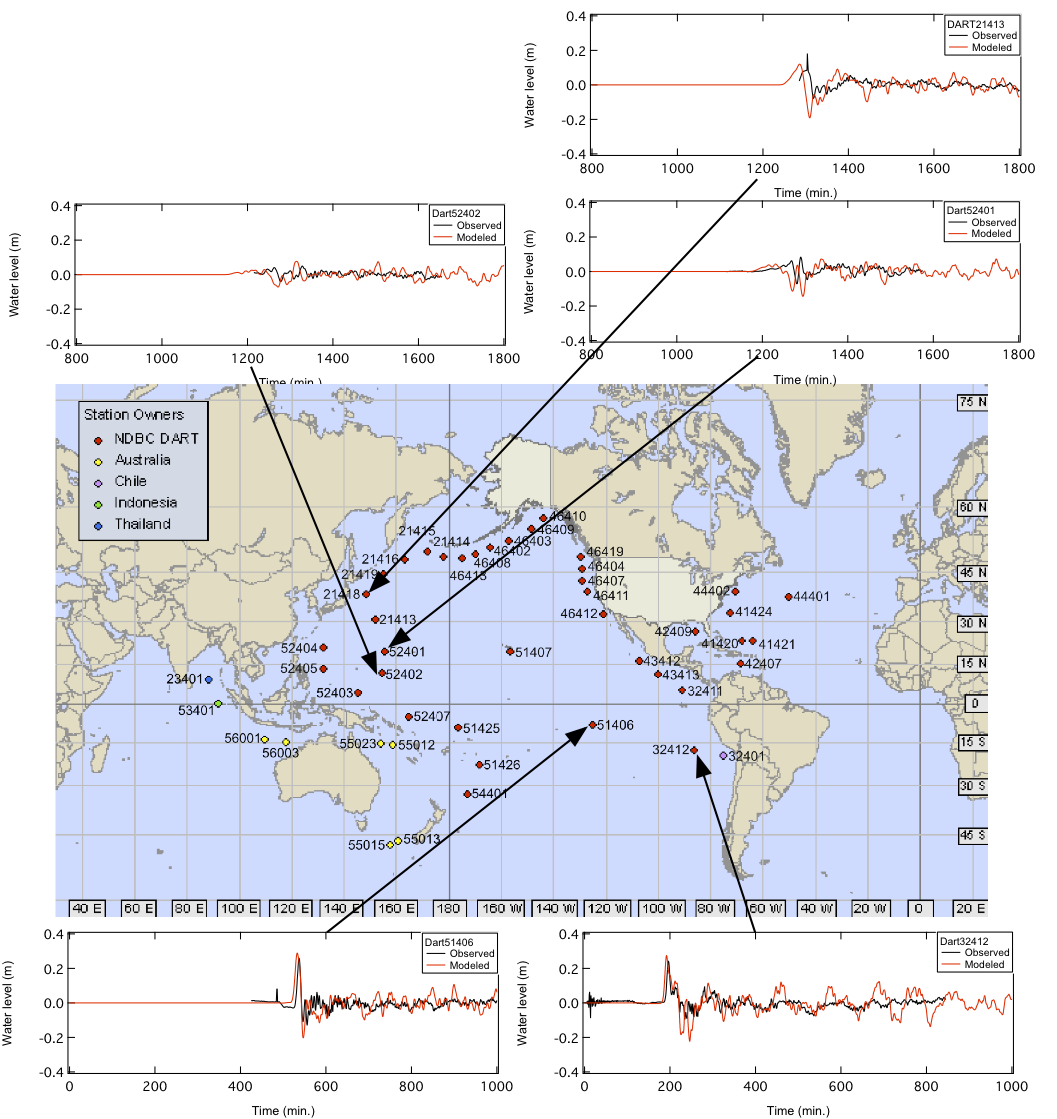
Tsunami Waveforms
For original figure (PDF), click the image below.
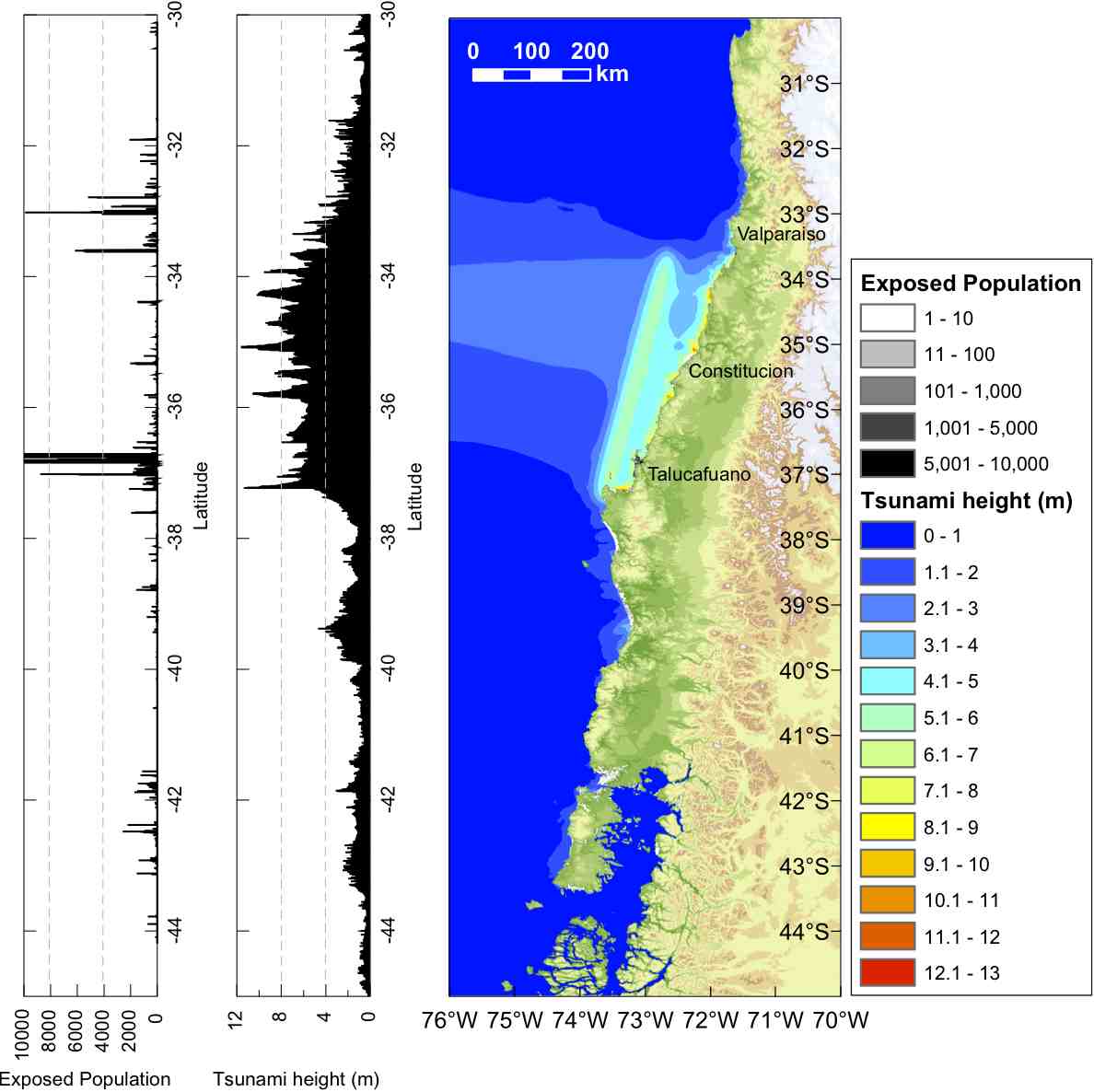
Case 1
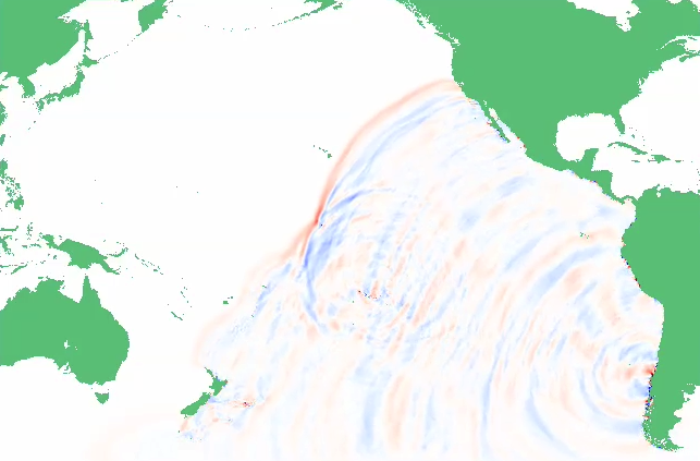
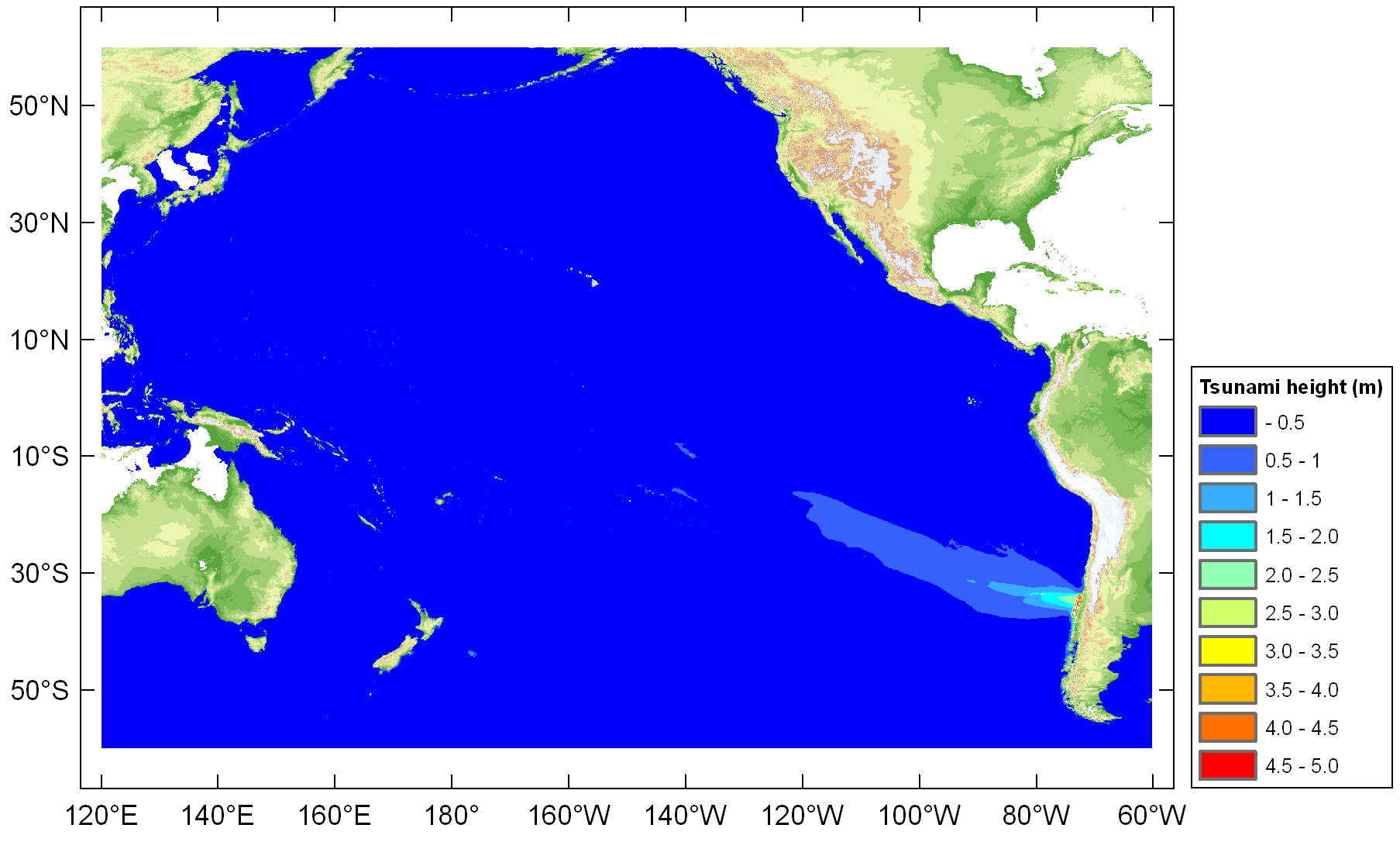
Tsunami in the Pacific
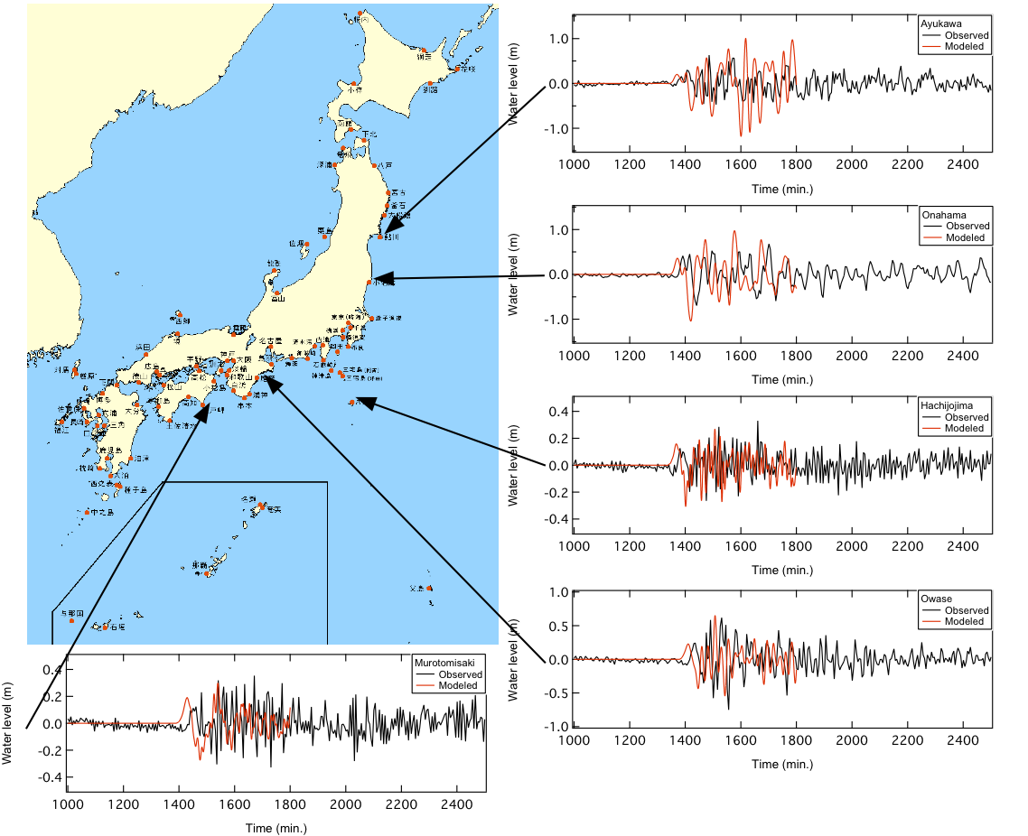
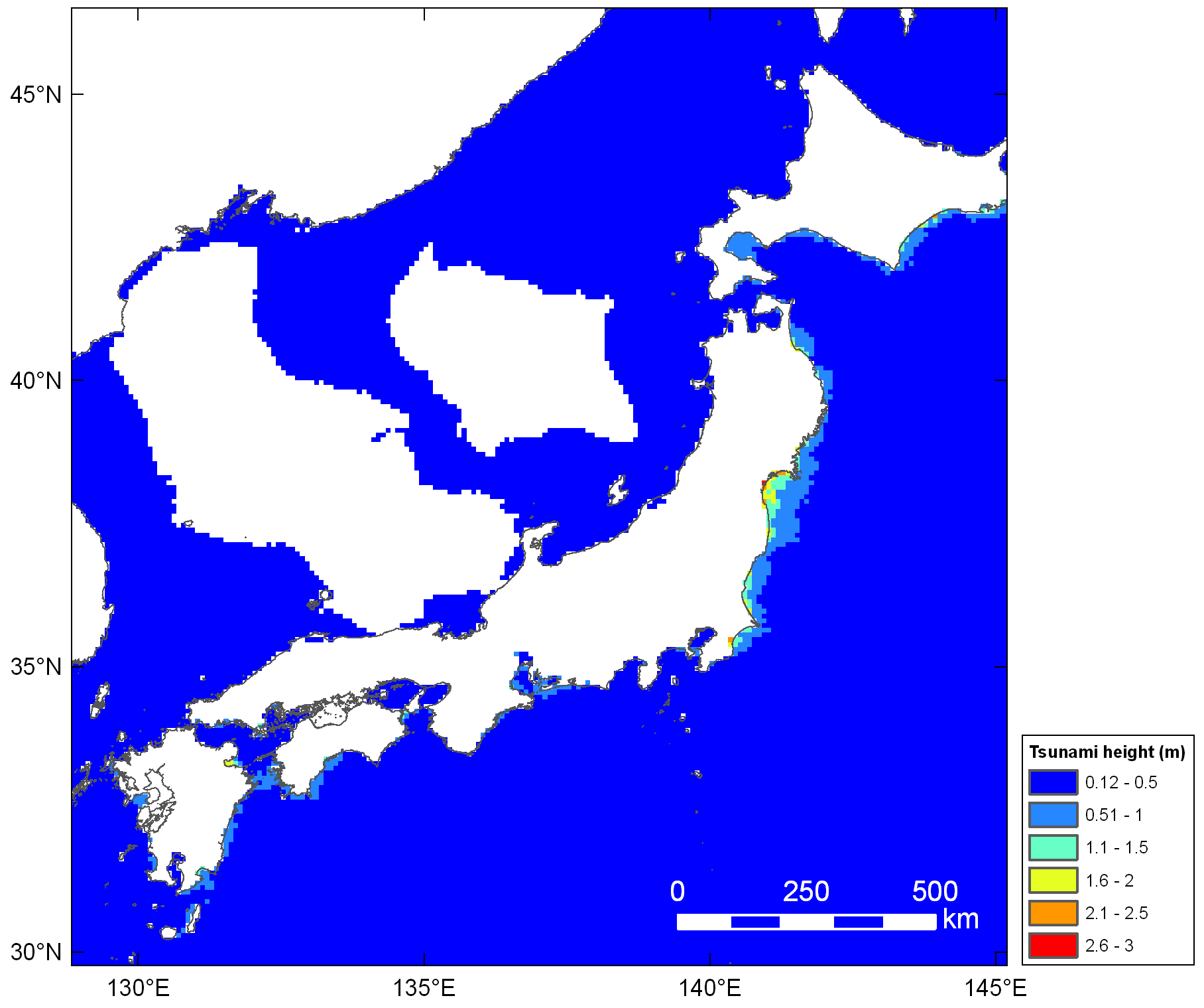
Pacific coast of Japan
Modeled Tsunami Height and Exposed Population
Modeled tsunami height and Exposed population (Case1)
How fast can we detect the impact of natural disaster ? This is a very critical problem to be solved in order to reduce the fatalities by any kinds of natural disasters. Recent advances of seismology, numerical modeling with modern computing power, remote sensing, and GIS analysis expands the capability to detect the impact of major tsunami disaster, as reported herein.
Modeled tsunami
Modeled tsunami along the Pacific coast of Japan
Modeled tsunami and exposed population in tsunami source area
Resources
- Koshimura, S., T. Oie, H. Yanagisawa, and F. Imamura, Developing fragility functions for tsunami damage estimation using numerical model and post--tsunami data from Banda Aceh, Indonesia, Coastal Engineering Journal, JSCE, Vol.51, No.3, pp.243-273, 2009
- Koshimura, S., M. Matsuoka and S. Kayaba, Integrated Approach to Assess the Impact of Tsunami Disaster, Proceedings of ICOSSAR 2009, pp.2302-2307, 2009 (Safety, Reliability and Risk of Structures, Infrastructures and Engineering Systems - Furuta, Frangopol & Shinozuka (eds.), 2010 Taylor & Francis Group, London) (Published paper)
- Dobson, J. E., E. A. Bright, P. R. Coleman, R.C. Durfee & B. A. Worley, LandScan: A Global Population Data-base for Estimating Populations at Risk," Photogrammetric Engineering & Remote Sensing Vol. 66, No. 7, 849-857, 2000.
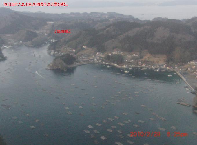
Reconnaissance
Click the image below.
Karakuwa, Miygi Pref.
Karakuwa, Miygi Pref.
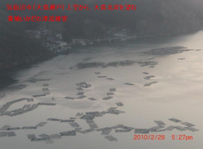
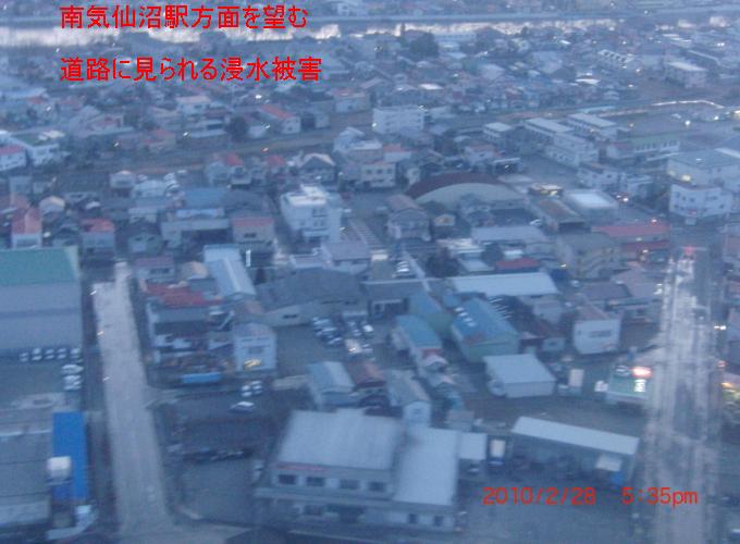
Kesen-numa, Miygi Pref.
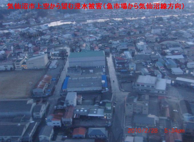
Kesen-numa, Miygi Pref.