![]()
An earthquake with M8.0 occurred offshore the Santa Cruz Islands in the Solomon Islands generated a local destructive tsunami near the tsunami source. There were dozens of foreshocks and aftershocks before and after the main shock. The mainly affected area is in Temotu Province where the reported tsunami height of 1.5 m damaged or swept away more than a hundred houses, claimed at least nine people and led more than 3,000 people displaced. In Lata, the capital of the Temotu Province, airport runway was flooded and the tsunami penetrated inland by approximately 500 m. The earthquake and tsunami also caused water and electricity shortage affecting more than 2,000 people. Smaller tsunamis of 26 cm and 55 cm propagated to Vanuatu and New Caledonia respectively whereas the maximum tsunami of 40 cm was observed in Japan. Tsunami evacuation was observed in some places such as in the main area of Solomon Islands and Fiji where people evacuated quickly without panic but caused traffic jam was confirmed. Evacuation from the far-field tsunami was also observed in Japan. In 2007, Solomon Islands were stuck by a tsunami generated by an M8.1 earthquake in 2 April 2007 near the provincial capital of Gizo Island. At that time, the measured maximum tsunami runup was 12 m which destroyed 900 houses and killed 52 peoples.
Distribution of aftershocks
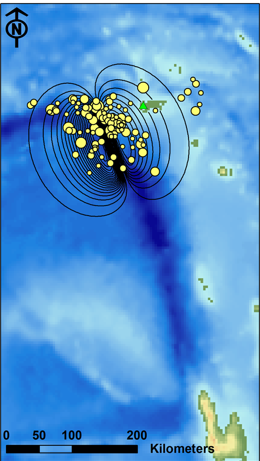
(Green triangle represents tide station at Lata)
![]()
![]()
![]()
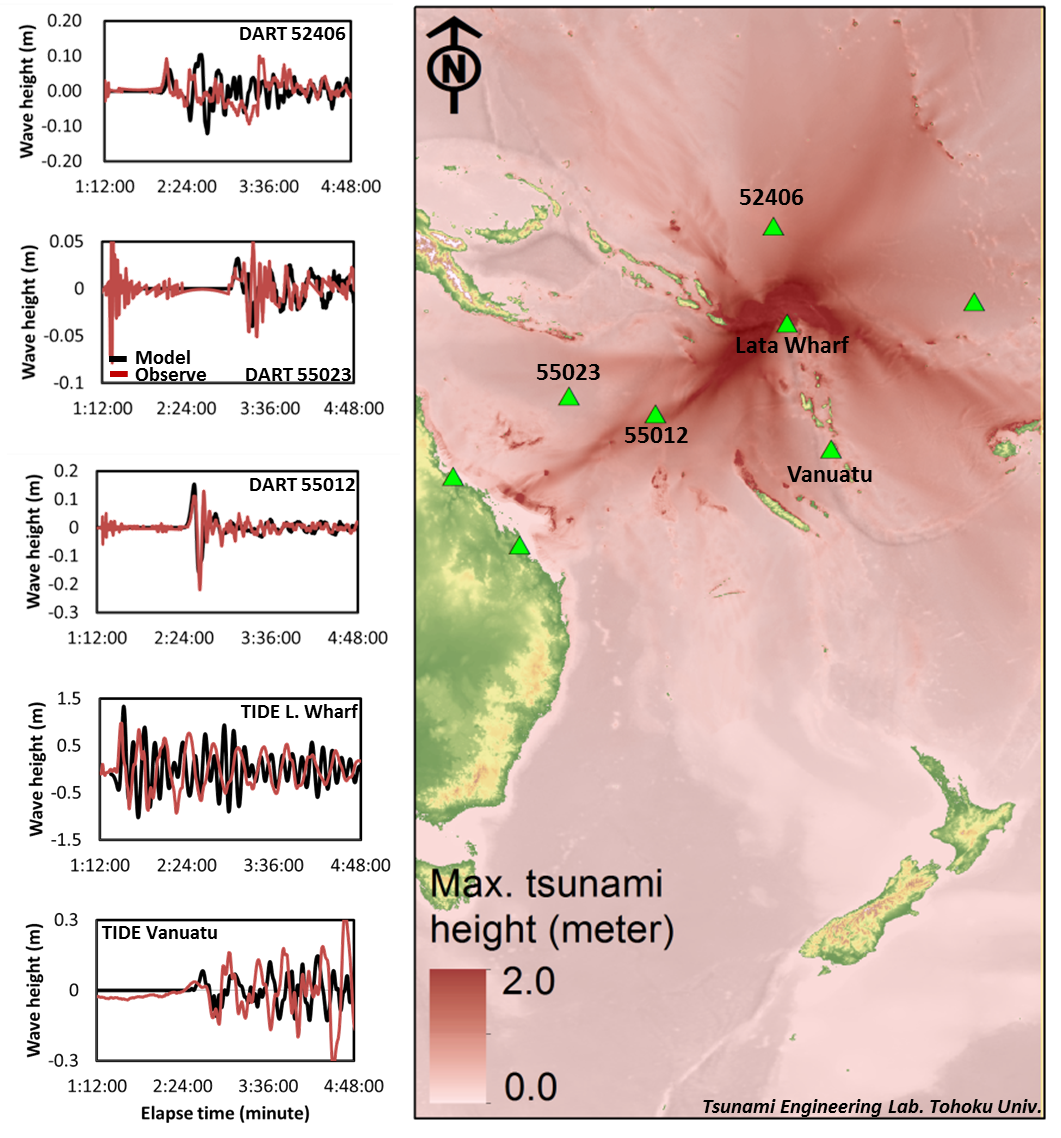
Modeled maximum tsunami height and comparison of waveforms
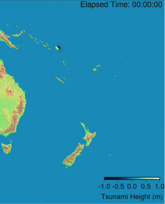
Local tsunami in Solomon Islands and nearby regions
![]()
Local tsunami in Solomon Islands and nearby regions (MPEG-1 Video: 14.7 MB)
![]()
by:
F. Imamura, K. Imai, M. Abdul and H. Kimura
(Tsunami Engineering, Hazard and Risk Evaluation Research Division)
E. Mas
J. D. Bricker
(Technology for Global Disaster Risk, Hazard and Risk Evaluation Research Division)
A. Suppasri, Y. Fukutani and Y. Abe
(Earthquake induced Tsunami Risk Evaluation (Tokio Marine), Endowed Research Division)